Douglas Macfarlan: Antiquarian, Cartographer, Otolaryngologist
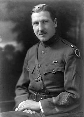
Dr. Douglas Macfarlan (1886-1966) left his professional mark on the prevention and treatment of deafness, establishing clinics and hearing testing in public schools. An enthusiastic local and family historian, he was active in the Pennsylvania, Montgomery County and Valley Forge Historical Societies and the St. Andrews Society.
We remember him as a co-founder of the Lower Merion Historical Society and our second president (1954 to 1960). “Macfarlan was the voice” of the Society, wrote journalist David Schmidt in Celebrating Their Own History in 1999.
As this gallery demonstrates, he was an accomplished artist and mapmaker as well.
The Maps
Click the maps to open a fullscreen version.

Colonial Roads, Fords and Ferries near Philadelphia (1934)
23″ × 18″; LMHS #FF044
Transcription
The earliest routes of travel were Indian trails and waterways. Later, as the country became settled, roads evolved from commonly used tracks made by farmers and traders bringing their grain or goods to mill or to town. To establish a road the court was petitioned, a description of the route given, and, after a survey was made, and objections cleared, the petition was granted. Still later, improved roads were charted as turnpikes, and toll was charged for upkeep. For crossing streams and rivers, fords preceded ferries. Finally bridges were erected. The first bridge at the Schuylkill was built in 1800.
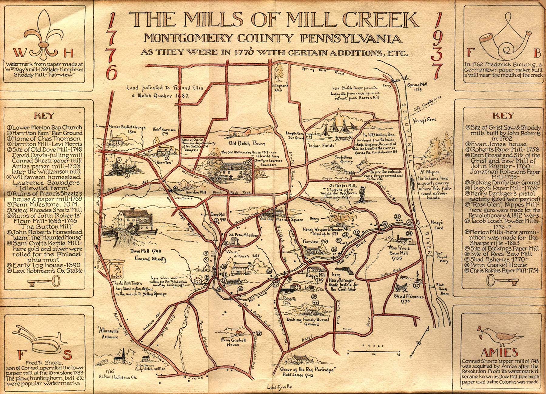
The Mills of Mill Creek (1937)
…Montgomery County, Pennsylvania as They Were in 1776 with Certain Additions, etc.
“This creek was a hive of industry in the early days. Flour was ground, logs were sawed, paper was made, and gun powder was manufactured. Later many of the mills became cotton factories. Early in the last century [1800s] steam began to supplant water-power for the mills.” — From Macfarlan’s lecture notes
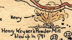 Detail: Henry Keyser’s powder mill blew up in 1791
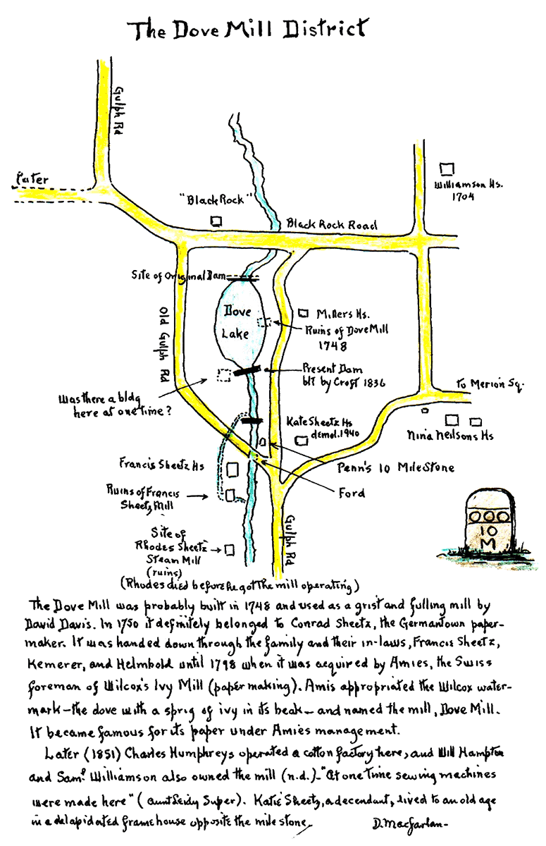
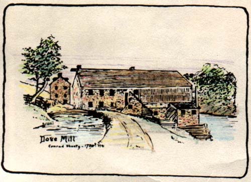
Dove Mill District (1941)
Transcription
The Dove Mill was probably built in 1743 and used as a grist and fulling mill by David Davis. In 1750 it definitely belopnged to Conrad Sheetz, the Germantown papermaker. It was handed down through the family and their in-laws, Francis Sheetz, Kemerer, and Helmbold until 1798 when it was acquired by Amies, the Swiss foreman of of Wilcox’s Ivy Mill (papermaking). Amis appropriated the Wilcox watermark – the dove with a sprig of ivy in its beak -and named the mill, Dove Mill. It became famous for its paper under Amies management.
Later (1851) Charles Humphreys operted a cotton factory here, and Will Hampton and Saml. Williamsion also owned the mill (n.d.). “At one time sewing machines were mad here” (Aunt Leidy Super). Katie sheetz, a descendant, lived to an old age in a dilapidated frame house opposite the [10] milestone.
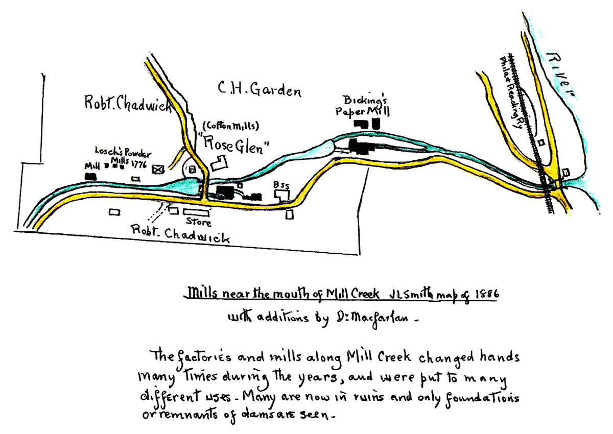
Mills near the mouth of Mill Creek
J.L. Smith map of 1886 with additions by Dr. Macfarlan.
The factories and mills along Mill Creek changed hands many times during the years, and were put to many different uses. Many are now in ruins and only foundations or remnants of dams are seen.
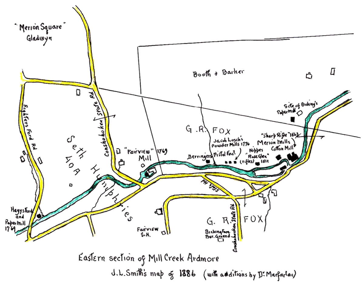
Eastern section of Mill Creek
J.L. Smith map of 1886 with additions by Dr. Macfarlan.

Old Homes, Mills, Schools, Parks, Play Grounds & Public Improvements (1942)
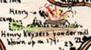 Detail: Henry Keyser’s powder mill blown up in 1791
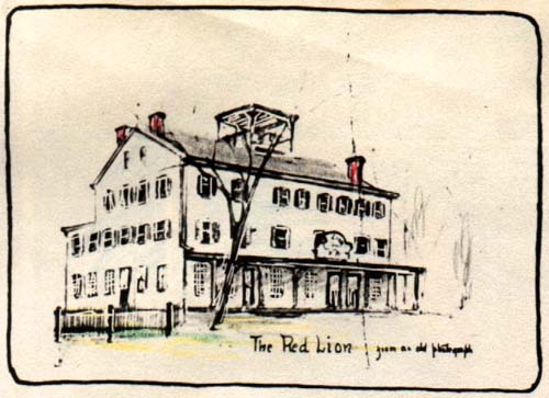
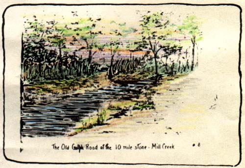
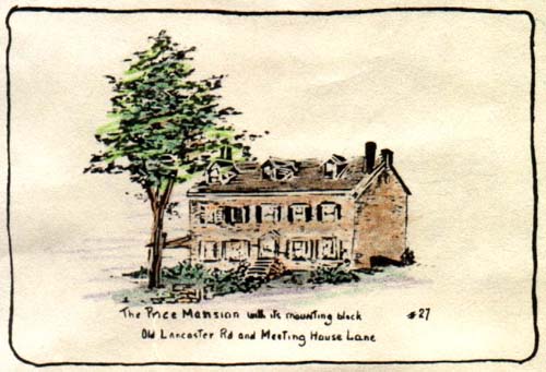
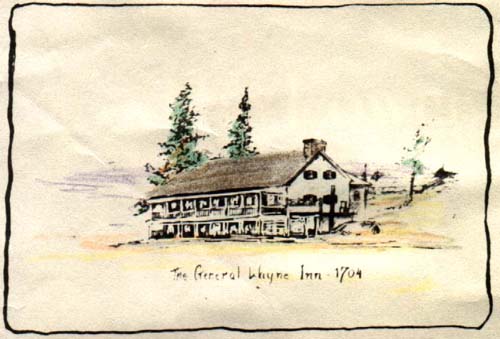
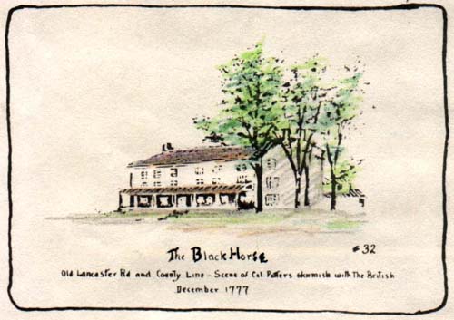
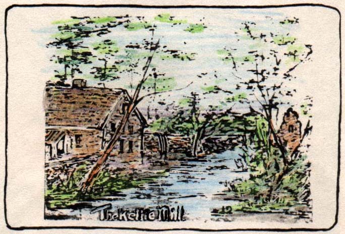
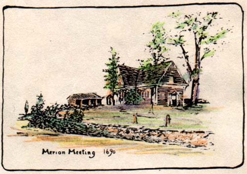
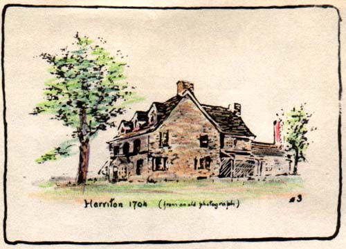
Watercolors of Landmark Buildings
From LMHS #FF078 Map of the Historic Mainline; border of 20 sketches of local buildings.
Macfarlan’s Ellerslie
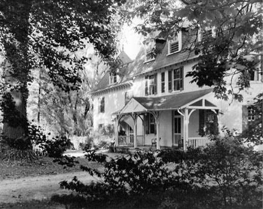
Another portion of [Wynne Wood] the original Jones holding near Church Road was sold to Dr. Malcolm and Hannah Macfarlan in 1894. The Macfarlans purchased Homeworth, a remodeled house of the early nineteenth century, and named by Jonathan Jones’ widow, Mary Thomas Jones, in 1840. They changed the name of the house to Ellerslie, Dr. Macfarlan’s birthplace in Scotland, and built three additional houses at 201, 207, and 213 Church Road. They had bought Ellerslie for a summer residence, and the property was used as a small farm. Dr. Douglas Macfarlan, one of the founders of the Lower Merion Historical Society, grew up there, and, after 1930, lived there with his wife. His interest in local history and his sketches of historic buildings have conserved knowledge of the area’s past. After his death in 1966, the Philadelphia Electric Company purchased the property and resold it. Ellerslie was razed, and luxury homes were built in the late 1970s on the land, some of which the township reserved for recreation.
—from “Lower Merion” by Phyllis C. Maier, chapter 25 of Montgomery County: The Second Hundred Years (1983)
Photographs of Dr. Macfarlan and Ellerslie courtesy Ruth Freeman, his granddaughter.