Local Antique Maps
The Society holds in its collections hundreds of standalone maps: property maps, theme maps, and where a historical map has been found wanting, maps hand drawn by local antiquarians. Here is a sampling; many more can be found in our Flat File collection and examined at the Academy.
Click a map thumbnail to examine it fullscreen.
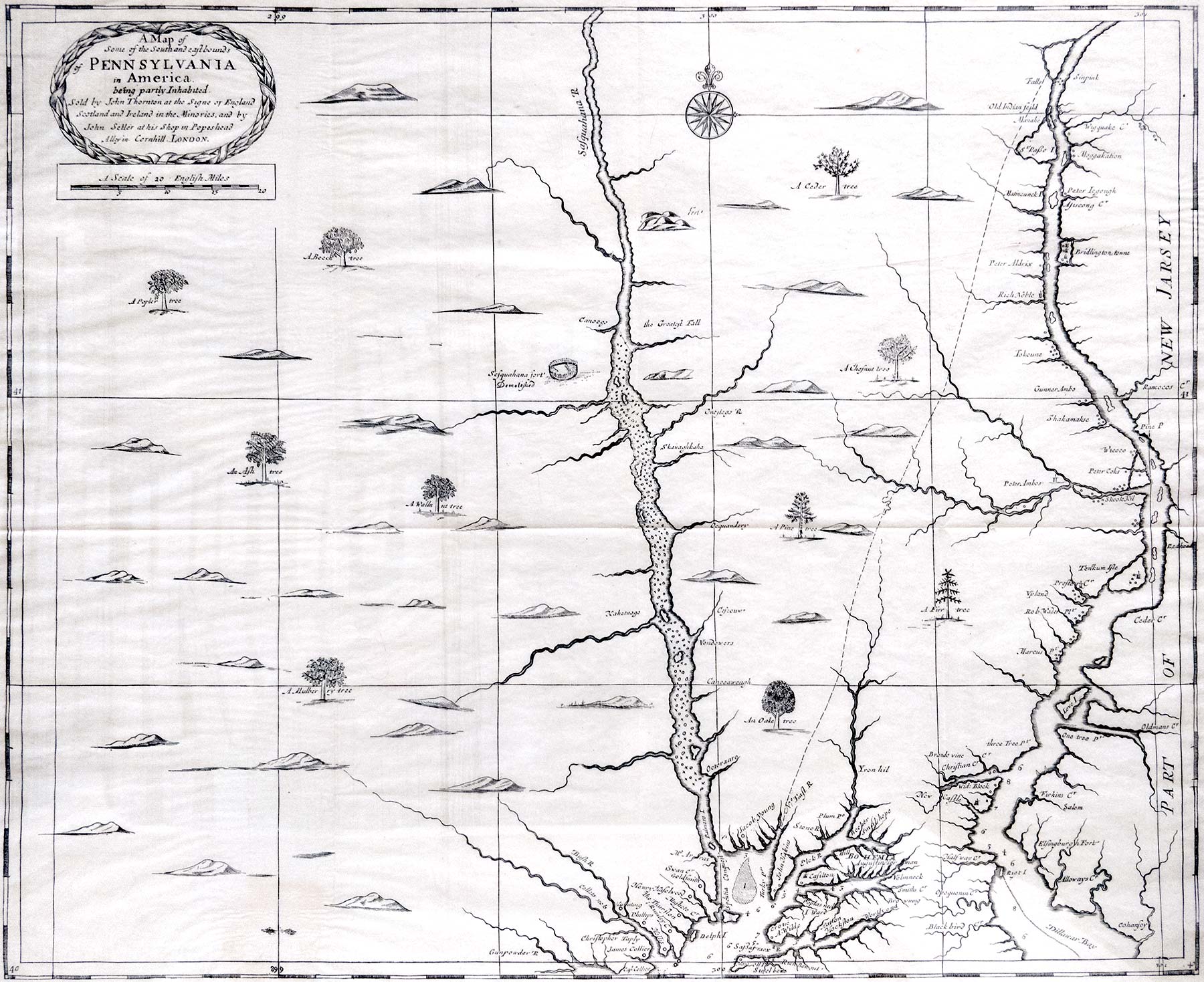
A Map of Some of the South and Eastbounds of Pennsylvania in America being Partly Inhabited (1681)
Sold by John Thorton at the Signe of England, Scotland and Ireland in the Minories, and by John Seller at His Shop in Popeshead Alley in Cornhill, London.
First Map of Pennsylvania Under William Penn, 1681
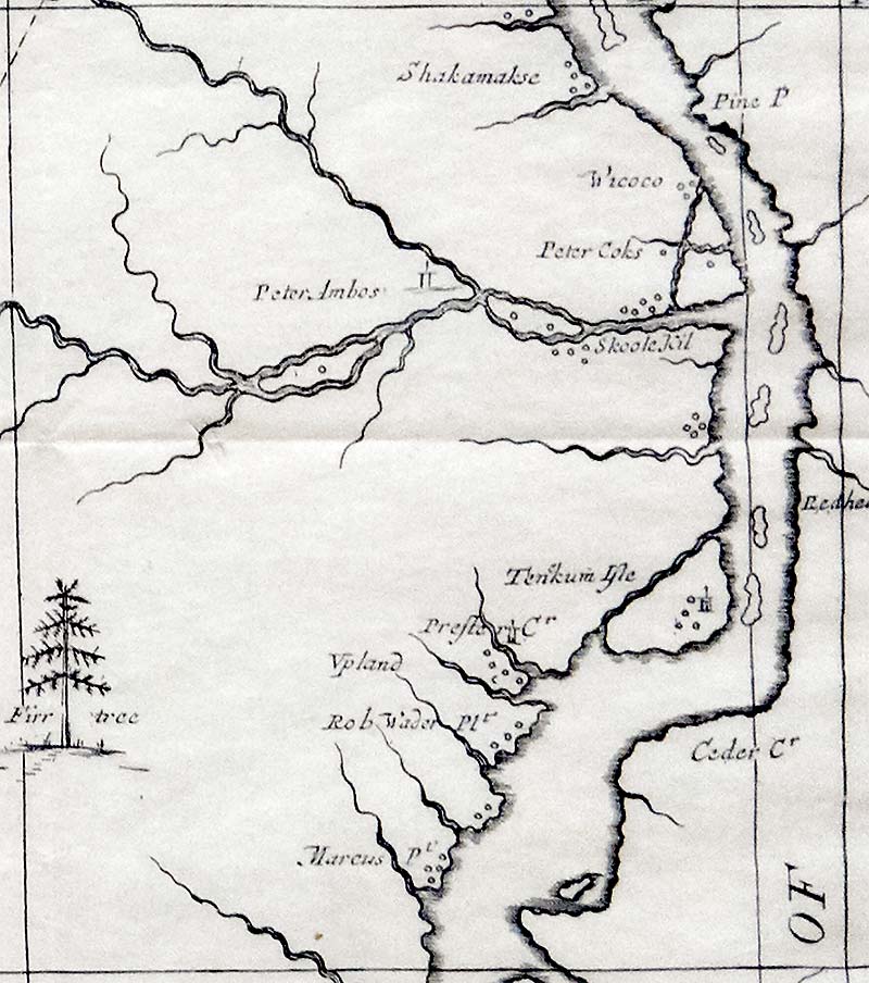 Detail: area around the mouth of the Skoole Kil
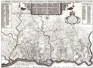
A Mapp of ye Improved Part of Pennsylvania in America (1687)
Divided into Countyes, Townships and Lotts. Surveyed by Thomas Holme. Sold by George Willdey at the Great Toy, Spectacle, and Print Shop, at the corner of Ludgate Street, near St. Paul’s, London.
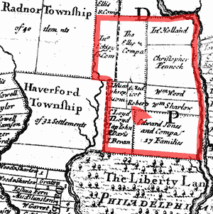 Detail with Lower Merion and Narberth outlined
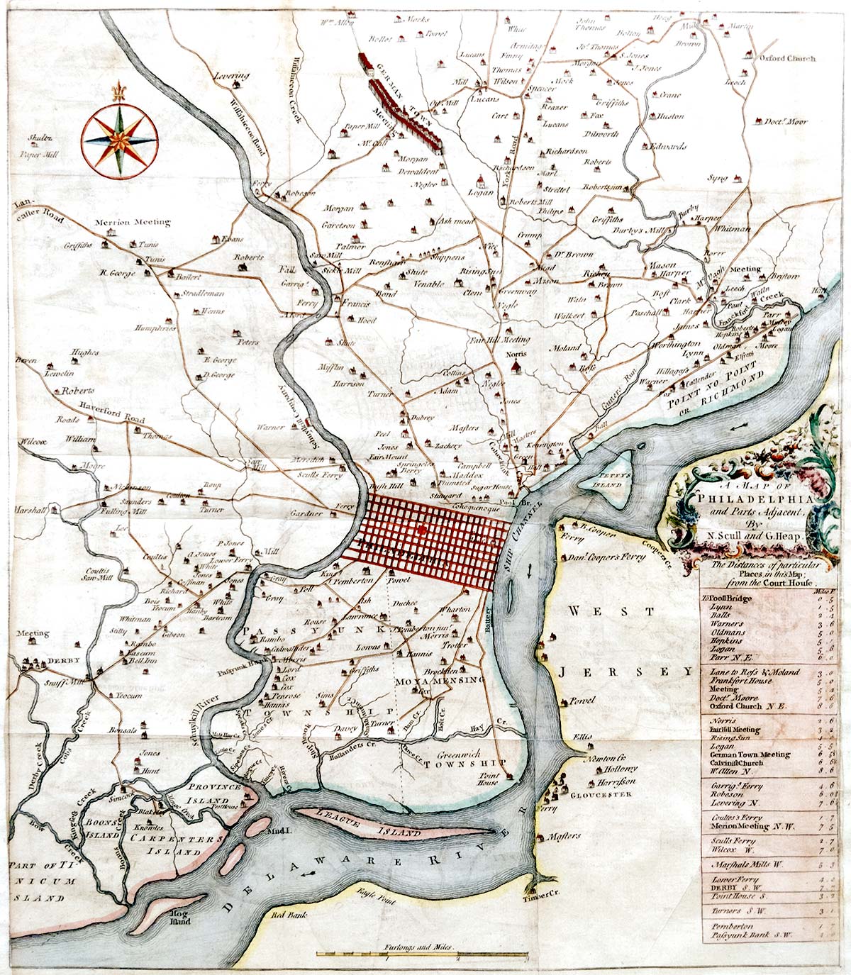
A Map of Philadelphia and Parts Adjacent (1753)
By N. Scull and G. Heap. This version of the map was printed in London using black ink on white paper and included in the August 1753 edition of The Gentleman’s Magazine.
 Detail: Lower Merion
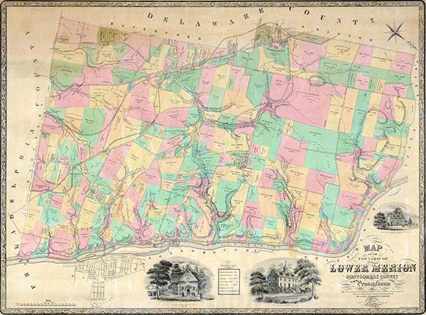
Map of the Township of Lower Merion, Montgomery County, Pennsylvania (1851)
John Howell Levering produced the first map of Lower Merion, based on the 1850 census. Levering was an employee of the surveying and civil engineering departments of the City of Philadelphia, and the Levering family was the owner of grist and saw mills in Lower Merion from the 1700s.
The map is oriented with the Schuylkill River at the bottom, so that its top faces towards the southwest. Virtually all subsequent maps adopted the modern convention of placing north at the top. Printed in color by L. Sinclair’s Lithographs, Philadelphia.
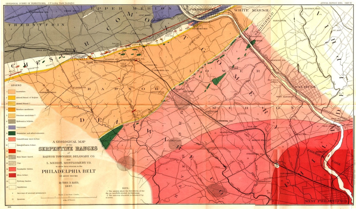
A Geological Map (1887)
…of the Serpentine Ranges of Radnor Township, Delaware County and Lower Merion, Montgomery County to Show Their Relation to the Philadelphia Belt of Azoic Rocks. By Theo. D. Rand 1887. Geological Survey of Pennsylvania, Annual Report 1886 Part IV. J.P. Lesley State Geologist.
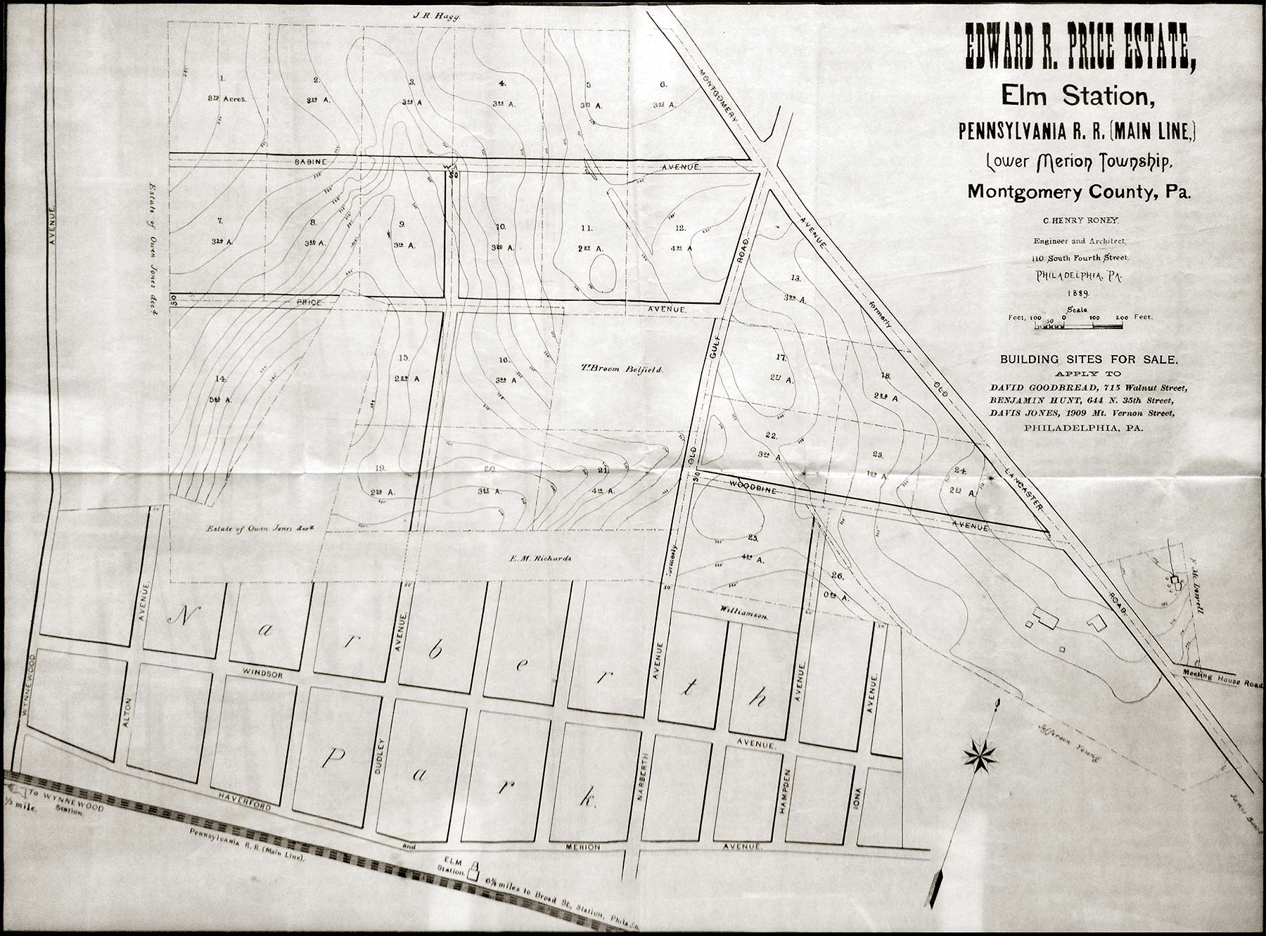
Edward R. Price Estate (1889)
Elm Station, Pennsylvania R. R. (Main Line). Building Sites for Sale.
This offering was made two years after death of future Narberth’s founder, the last of his original Welsh Tract family.
Visible are the alphabetical street layout of the one-year-old Narberth Park development to the south, including the never-constructed “A” street, Alton (bottom left); and the contours of the trackbed of the Philadelphia and Columbia railroad (top right, parallel to Montgomery Avenue), by then defunct for 50 years.
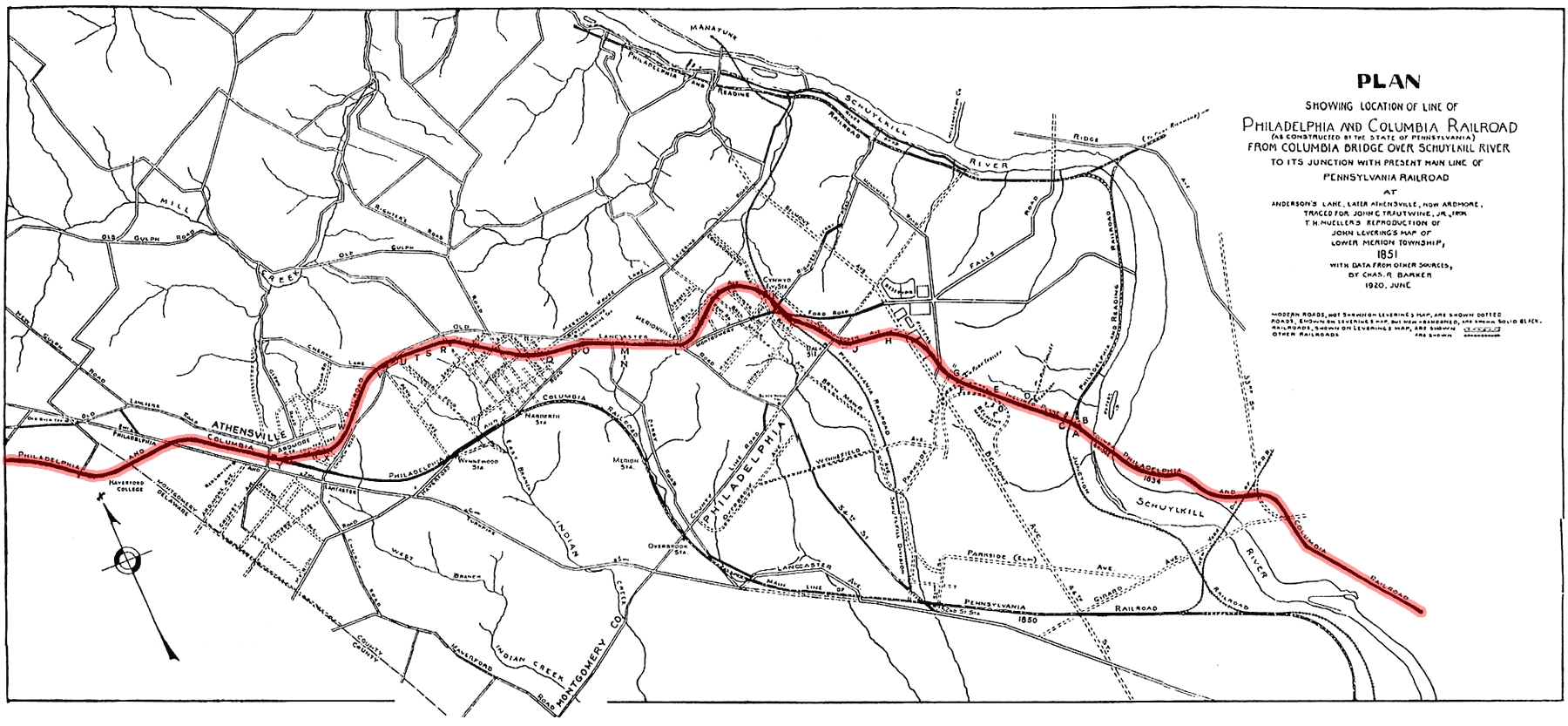
Plan Showing Location of Philadelphia and Columbia Railroad (1920)
(as Constructed by the State of Pennsylvania) from Columbia Bridge over Schuykill Rover to its Junction with Present Main Line of Pennsylvania Railroad at Anderson’s Lane, Later Athensville, Now Ardmore. Traced for John C. Trautwine, Jr. from T. H. [A. H.] Mueller’s reproduction of John Levering’s Map of Lower Merion Township, 1851 with data from other sources by Charles R. Barker, June 1920.
The route of the railroad is highlighted.

The Main Line: A Historical Map of ye Outlying Regions (1946)
Made for Your Enjoyment by Sally Jean & Nancy Robertson & Drawn by Hugh Robertson during the very cold winter of 1942. Revised & Corrected 1946.

 Detail with Lower Merion and Narberth outlined
 Detail: Lower Merion