Lower Merion Historical Society

The Lower Merion Historical Society

« Lower Merion History

Main Line Atlases Collection

1871 Edition. “Atlas of the County of Montgomery and the State of Pennsylvania.” From Actual Surveys & Official Records. Compiled & Published by G.M. Hopkins & Co., 320 Walnut Street, Philadelphia, Pennsylvania.

1877 Edition. “Combination Atlas Map of Montgomery County, Pennsylvania.” Compiled, Drawn and Published From Personal Examinations and Surveys. J.D. Scott, Philadelphia, Pennsylvania.

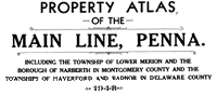
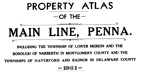
1881 Edition. “Atlas of Bryn Mawr and Vicinity or of Properties Along the Pennsylvania R.R. Including 1 1/2 Miles Each Side of the Road and From City Line to Malvern Station.” From Official Records, Private Plans and Actual Surveys. Published by G.M. Hopkins C.E., 320 Walnut Street, Philadelphia, Pennsylvania.

1887 Edition. “Atlas of Properties Along the Pennsylvania R.R. Embracing Two Miles Each Side of the Road and From Overbrook to Malvern Station.” Compiled From Official Records, Private Plans and Actual Surveys by G. Wm. Baist, Topographical Engineer. Published by J.L. Smith, 27 South Street, Philadelphia, Pennsylvania.

1893 Edition. “Atlas Map of Montgomery County, Pennsylvania.Compiled by M.A. Naeff, C.E. from Official Records, Private Plans and Actual Surveys.Published by J.L. Smith,Philadelphia, Pennsylvania.”
1896 Edition. “Atlas of Lower Merion, Montgomery County Including Part of Delaware County and Overbrook Farms, Wynnefield & Overbrook Impr. Co.,Philadelphia.” Compiled and Drawn from Official Plans and Actual Surveys by Ellis Kiser and C.A. Potts, Civil Engineers. Published by A.H. Mueller, 530 Locust Street, Philadelphia, Pennsylvania.
1900 Edition. “Atlas of Properties Along the Pennsylvania R.R. Embracing 1 to 4 miles Each Side of the Road and From Overbrook to Malvern Station.” Compiled From Official Records, Private Plans and Actual Surveys by E.V. Smith, Topographical Engineer. Published by J.L. Smith, 27 South Sixth Street, Philadelphia, Pennsylvania.
1908 Edition. “Atlas of Properties on Main Line Pennsylvania Railroad from Overbrook to Paoli.” Compiled from Actual Surveys, Official Record and Private Plans by Ellis Kiser, C.E., Under the Direct Management and Supervision of A.H. Mueller, Publisher, 530 Locust Street, Philadelphia, Pennsylvania.
1913 Edition. “Property Atlas Main Line Pennsylvania R.R. from Overbrook to Paoli Embracing Lower Merion, Haverford and Radnor Townships and Parts of Upper Merion, Easttown and Tredyffrin Townships.” Compiled From Actual Surveys, Official Records and Private Plans, by Ellis Kiser and J.M. Lathrop, Civil Engineers. Under the Direct Supervision and Management of A.H. Mueller, Publisher, 530 Locust Street, Philadelphia,
1920 Edition. “Atlas of Properties on Main Line Pennsylvania Railroad From Overbrook to Paoli.” Compiled From Actual Surveys, Official Records and Private Plans by Ellis Kiser and J.M. Lathrop, Civil Engineers and From Original Surveys by Milton R. Yerkes, C.E.. Under the Direct Supervision and Management of A.H. Mueller, Publisher, 530 Locust Street, Philadelphia, Pennsylvania.
1926 Edition. “Atlas of Properties on Main Line Pennsylvania Railroad From Overbrook to Paoli.” From Actual Surveys and Official Plans by George W. and Walter S. Bromley, Civil Engineers. Published by G.W. Bromley and Co., 147 North Fifth Street, Philadelphia, Pennsylvania.
1937 Edition. “Property Atlas of the Main Line, Penna. Including the Township of Lower Merion and the Borough of Narberth in Montgomery County and the Townships of Haverford and Radnor in Delaware County.” Complied from Official Records, Private Plans and Actual Surveys By and Under the Supervision of the Franklin Survey Company. Published by Franklin Survey Company, 210 North Thirteenth Street, Philadelphia, Pennsylvania.
1948 Edition. “Property Atlas of the Main Line, Penna. Including the Township of Lower Merion and the Borough of Narberth in Montgomery County and the Townships of Haverford and Radnor in Delaware County.” Complied from Official Records, Private Plans and Actual Surveys By and Under the Supervision of the Franklin Survey Company. Published by Franklin Survey Company, 210 North Thirteenth Street, Philadelphia, Pennsylvania.
1961 Edition. “Property Atlas of the Main Line, Penna. Including the Township of Lower Merion and the Borough of Narberth in Montgomery County and the Townships of Haverford and Radnor in Delaware County.” From Official Records, Private Plans and Actual Surveys. Compiled Under the Direction of and Published, Sold and Revised Exclusively by Franklin Survey Company, 116 North Seventh Street, Philadelphia, Pennsylvania.