The Milestones
Ancient Landmarks
As a unit of measure, the mile dates back to Roman times. The Latin is “milia passuum,” meaning a thousand paces. The Romans also erected stone markers at mile intervals to notify the passerby of distances covered or the number of miles to go to reach their destination. These markers were conveniently called milestones. Distances from Rome were measured from the “gilded column” in the Forum which was inscribed with the names of the principal roads and the distances of the major cities.
Colonial Landmarks
Early in American history, Philadelphia was a major city in Pennsylvania. Roads radiated in all directions like a spider’s web to the surrounding towns. Philadelphia’s equivalent of the Roman “gilded column” was located at the old Philadelphia Court House which stood on Market and Second Streets.
It was Benjamin Franklin, the Colonial Postmaster, who insisted on having milestones erected, because they expedited mail delivery by keeping the postal riders on schedule. These milestones also became popular as a way of identifying the location of a property. For example, on the 1752 Scull and Heap Map, under the “Table of Distances,” we find the Merion Meeting House listed as having the address of 7—5 (7 miles and 5 furlongs). Many inns were intentionally located near these markers because the innkeepers thought milestones brought them good luck and fortune. Finally, along the turnpike roads, these markers were a means for seeing that no person was charged for more miles than he traveled.
As a note of interest, Benjamin Franklin is credited with the invention of the “odometre.” This ingenious mechanical device was used to determine the exact location for each milestone. The “odometer” was attached to a carriage wheel and as it passed over the road it recorded the distance of a mile.
The Three Roadways
Granite milestones continue to mark the distance to Philadelphia along the rights-of-way of our three local roadways: Old Lancaster Road (now Montgomery Avenue), Old Gulph Road and Lancaster Road. There are a total of fourteen milestone sites that exist in Lower Merion. Let’s take a brief look…
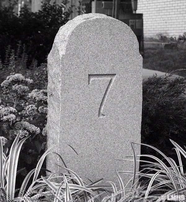
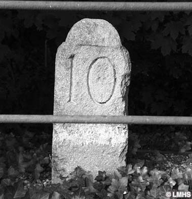
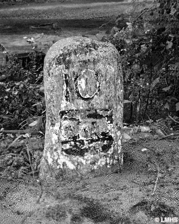
Old Lancaster Road
One of the oldest roadways in the state, Old Lancaster Road began as a Lenape foot path. After the arrival of the Welsh, the Religious Society of Friends (Quakers) established their Merion Meeting House and used this path to link them to the their fellow Quakers who lived and worshipped at the Great Meeting House at Second and High (Market) in Philadelphia. A short time later this path was extended in a westwardly direction to connect to the Radnor Meeting House.
There is no clear documentation when milestones 7 through 10 were installed, but they were probably in place by c. 1740. They were erected on the north side of this roadway and were inscribed with the appropriate mileage numeral on the front side.
Remove not the ancient landmark, which thy fathers have set —Proverbs 22.28
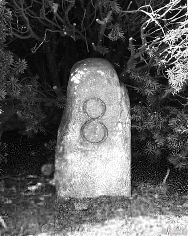
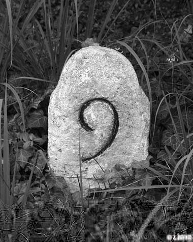
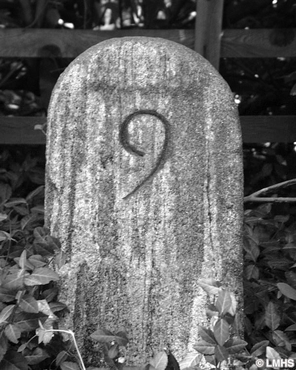
Old Gulph Road
Old Gulph Road, an extension of Old Lancaster Road, was constructed to enable the Welsh Quakers easy access into the Mill Creek Valley region. In the valley or gulph (a hollow place in the ground), they constructed their mills along Mill Creek which was used to power their grist, lumber, woolen, paper and powder mills.
Milestones 9 through 13 were erected on the north side of this roadway in c. 1793 by the Mutual Assurance Fire Company of Philadelphia as a price for their charter from the Penn family. Because of their unique design, this group of milestones is commonly referred to as “William Penn Milestones.” On the front side, which faces the roadway, there appears the appropriate mileage numeral, while on the back side are three raised cannon-balls on a bar within a shield which is the coat-of-arms of Admiral Sir William Penn.
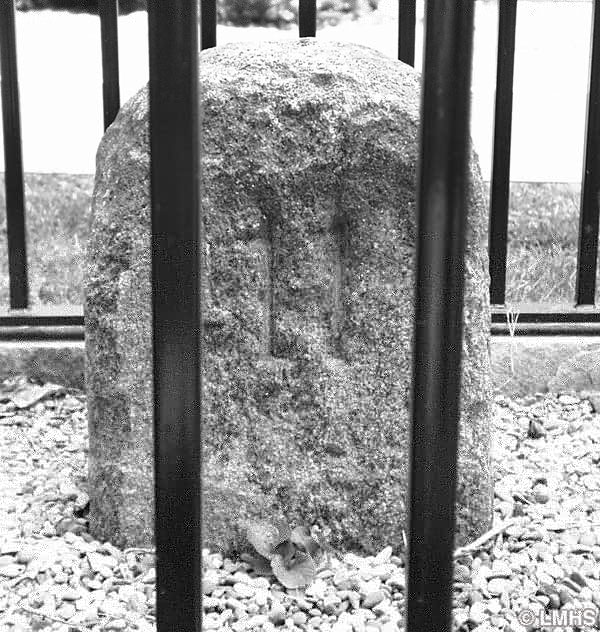
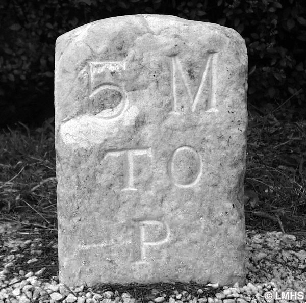
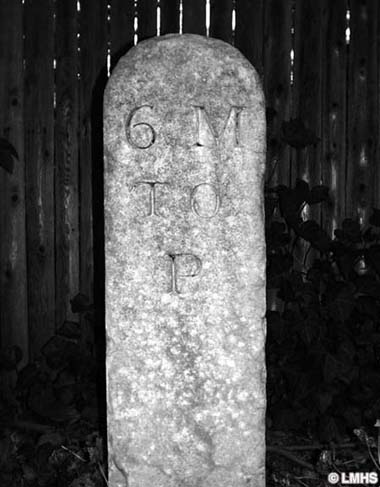
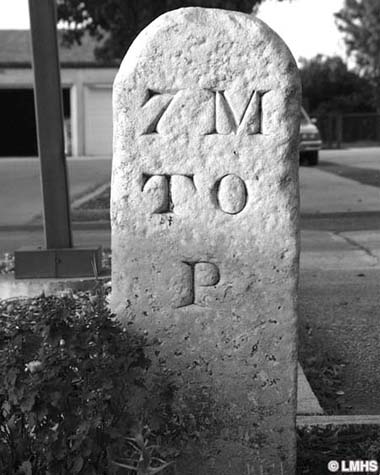
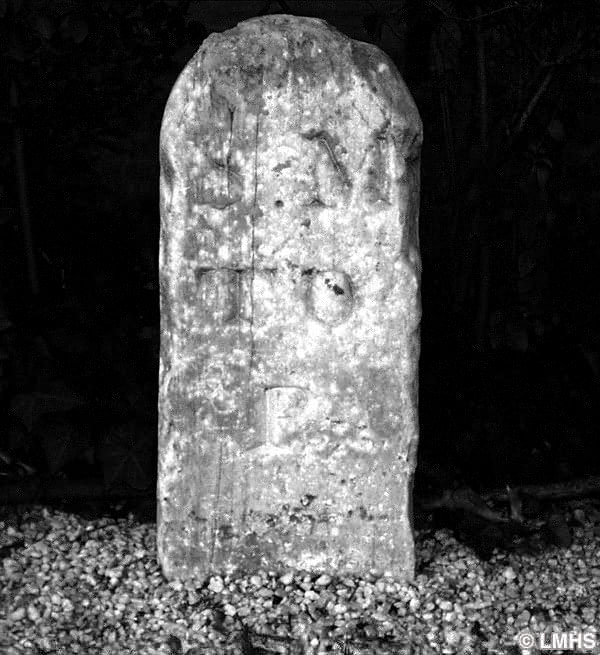
Lancaster Road
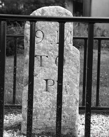
The War for Independence was over and the country was focused on opening up new territories to the west. Traffic was so heavy on the Old Lancaster Road that there was a demand for an additional road between Philadelphia and Lancaster. This led to the construction of the Lancaster Road (Route 30), which was completed in 1794 and called “The Great Road to the West.”
Milestones 5 through 9 were erected on the north side of this roadway in 1795 by Joseph Price who was awarded the contract by the State of Pennsylvania. It’s important to note that the Lancaster Road milestones used a different starting point of reference from the other two roadways. These marked the distance to the Market Street Bridge (30th Street) at the Schuylkill River. Therefore, there is a difference of two miles in their measurement to Philadelphia. On the front side, which faces the roadway, appears the appropriate mileage numeral followed by “M to P” or “Miles to Philadelphia.”